Purgatory-Mangisi Traverse: Hiking Tips

Background
Purgatory-Mangisi Traverse is a series of mountains namely Mt. Pack, Mt. Kokompol, Mt. Mangakew, Mt. Tangbaw, Mt. Bakian, and Mt. Purgatory.
This hiking destination features primeval mossy and pine forest, mountain communities and even a sea of clouds making Purgatory - Mangisi Traverse a must try for any would-be mountaineers.
Mt. Purgatory got its unique, but a bit notorious name from two American soldiers who used to man an observation post in one of its many peaks. The soldiers described that the mountain is too cold as if they really were in Purgatory. The remark stuck thus the name of the mountain.
The Team
The climb was organized by Team iClimb, headed by one of the finest organizers I've met, Sir Alfred Asan III. The climb date was June 2 - 3 2018.
 |
| Team iClimb headed by Sir Alfred Asan III |
Fast Facts
Difficulty: 6/9, Major Climb
Elevation: 2329 MASL at the highest point
Trail Description: Mossy Forest, Mountain communities
Starting Point: Brgy. Japas, Bokod, Benguet
Ending Point: Brgy. Ekip, Bokod, Benguet
Guide/s: Required
Rope Segments: None
Elevation: 2329 MASL at the highest point
Trail Description: Mossy Forest, Mountain communities
Starting Point: Brgy. Japas, Bokod, Benguet
Ending Point: Brgy. Ekip, Bokod, Benguet
Guide/s: Required
Rope Segments: None
Tale of the Trail
The entire trail can be divided into three segments based from the characteristics of its surrounding. The initial part of the trail is through mountain communities, the second part cuts through a mossy forest and the third, from the last mountain to the exit point is through a pine forest.
After a seven-hour ride from Manila, we had finally arrived at the JOP at Brgy. Japas in Bokod, Benguet. After stretching a bit, we started walking towards the registration area where we'd met the Local Tourism and DENR officers. The territory where Mt. Purgatory is situated is part of the Ancestral Domains of multiple ethnic groups of Cordillera and also a protected landscape by the DENR. Such as this, all would-be climbers of Purgatory-Mangisi are required to participate in an orientation seminar.
The orientation seminar will last for about thirty minutes. Try to maximise your time in the registration area. Listen intently to familiarize yourself not only to the description of the trail but also to gain insights about the culture and way of life of the people.
Two guides were assigned for our group.
 |
| Purgatory-Mangisi Traverse Map |

First Segment
From the registration area, we went back to the road and had a short prayer of thanks and blessing before hitting the trail.
The initial trail was through a forest and mountain communities. The trail was a gradual ascent with thick forest cover so you are protected from the punishing sun rays. It will take you about an hour or less, depending on your pace to reach the first of the many mountains in Purgatory Mangisi Traverse, Mt. Mangakew
Mt. Mangakew has a mountain community on top, so people still have access to electricity and running water. We took this chance to refill our water bottles and use their facilities since you'll be more or less cut-off from the usual comforts of home beyond this point.
 |
| Mt. Mangagew, the first mountain of Purgatory-Mangisi Traverse |
From Mt. Mangakew, it will take you another an hour or two to reach Mt. Pack. Going there is a bit more challenging since you will have to leave the forest cover on the first part. The trail from Mt. Mangakew to Mt. Pack will start off descending, so everyone knows that the next part will be an unforgiving ascend.
The top of this mountain has lots of foliage so the view is not really on the actual summit but a few meters away from it. Just make sure to be careful in your wanderings since deep ravine may be concealed by the flora. At this point of our climb, we can feel the sudden drop in the temperature as the clouds slowly descended on us.
 |
| Blogger at Mt. Pack |
We stayed atop Mt. Pack for only 30 minutes before deciding to proceed to probably the most arduous part of our Purgatory-Mangisi Traverse, the mossy forest trail to Mt. Purgatory.
Second Segment
The sky darkened, threatening to give us a shower. So from Mt. Pack, we decided to hit the trail again despite the fact that we were there for only few minutes. We were kinda wearied that the trail will be infinitely more difficult if the sky decided to let us have it while we're inside the mossy forest.
The mossy forest trail looks like a landscape from a mystical stories in fairy tales. Feast your eyes on the wonderful flora inside the forest. The trail will take about 3 hours before you reach Mt. Purgatory. Changes in elevation inside the Mossy Forest is minimal. However, the challenge we'd encounter was the low lying branches and leaves that may scratch or entangle you as you navigate thru this almost-mystical place. At first, we are much engrossed with the primeval beauty of the mossy forest, but after hours of walking inside it, you'll want to get out of there fast.
 |
| The Mossy Forest |
A Bit of Supernatural
Halfway thru our hike within the mossy forest, I was looking at the ground for a minute when someone shoved me and run ahead. I looked up and realized that one of our members ran ahead as if running away from something. When asked, she answered that while walking, she saw a small, dark figure watching her by the side of the trail. She was creeped the hell out so she ran ahead.
It was a hell of a motivating factor as we quickened our pace upon hearing her story.
 |
| Mt. Purgatory, yey! |
After three and a half hours of walking inside the mossy forest, we finally reached Mt. Purgatory. There's a general sigh of relief as we are finally out of the labyrinth-like forest.
We had a few minutes of rest and picture taking at Mt. Purgatory. We took an extended break to recuperate from the long walk. I personally asked Mr. Alfred Asan if there will be more mossy forest ahead. When he answered no, I felt so relieved. Whew!
 |
| The team at Mt. Purgatory |
From Mt. Purgatory, our next stop was Bakian Village followed by Tangbaw, where our homestay was located. The trail going to Bakian Village has a very different vibe to that of the previous trail. The ground is covered by pine needles, and from it, you can see more of the sceneries of Cordillera.
Dips and assaults are in the minimum from here on forward so I personally enjoyed this part. It will take you about an hour and a half before you reach Bakian Village. We breezed through Bakian Village since the night was fast approaching and everyone was more eager to reach the homestay than have another sidetrip (including me).

Tangbaw is just a stones throw away from Bakian Village. It took us only 15 or so minutes before we reached the quaint village of Mt. Tangbaw. Sir Alfred quickly put in the work for our dinner. By nightfall, we finally got the chance to fill our stomach with something substantial, sinigang with rice.
After dinner, we had a bit of socials before I dozed off to dreamland.
Second Day
I was the first one (or so I thought) to woke up the next day. The temperature was refreshingly cold. I was quick to explore the village and its vicinity, walking up and down the slope near our homestay and just appreciating this piece of paradise. When I came back, everyone was up and preparing themselves for the last mountain in our itinerary, Mt. Kokompol.
A handful of our members decided to stay in the homestay to rest since our itinerary changed a bit. Instead of doing the entire traverse, we will climb Mt. Kokompol then backtrack to homestay to pick up our things before proceeding to the exit point from Tangbaw . We did not proceed with the usual itinerary since a landslide made the trail from Mt. Kokompol to exit point more perilous.
 |
| Sea of Clouds as seen from Tangbaw Viewpoint |
From Tangbaw Campsite, it will take you 50 minutes to reach Mt. Kokompol. The trail is scenic with gradual ascents. Fifteen minutes before the summit, you will enter a forest where the trail increase in steepness.
We were bit in a hurry since other groups are also aiming to summit Mt. Kokompol the same time as we. We were able to be the second team to reach the summit (yey for us!)
The view on Mt. Kokompol is just amazing. It is not an understatement to say that this place is where dream and reality meets. I was quite surprise to see a sea of clouds since there are only few literatures mentioning the sea of clouds in Purgatory-Mangisi. Watch as the sun slowly disperse the low clouds, showing the Cordillera mountain range with all its glory.
 |
| Sir Rommel at Kokompol Marker |
 |
| Sir Al, with the sea of clouds as his background |
After having our fill of awesomeness of the view, we went back to our homestay in a much quicker pace. After collecting our things and tidying up the place, we bid our farewell to our good host.

After an hour, you'll see a sari-sari store where you can rest for a while. From this point, the trail will cut through mountain communities, meaning you'll have to walk on cemented trails which I very much believe to be brutal on your knees. This community walk will last for about an hour also.
Then yet another hour, you'll be pretty much be in the middle of nowhere again. There will be some ascents but do not worry since you are nearing the conclusion of your climb. I'm not very fond of bringing my own trekking pole, so when the trail started getting steeper, I created my own expedient staff made of a tree branch.
The view on this part was simply spectacular. You can see the glorious Cordillera Mountains, as well as the seemingly endless rice terraces. There are some portions in this trail that the soil is loose so proceed with caution.


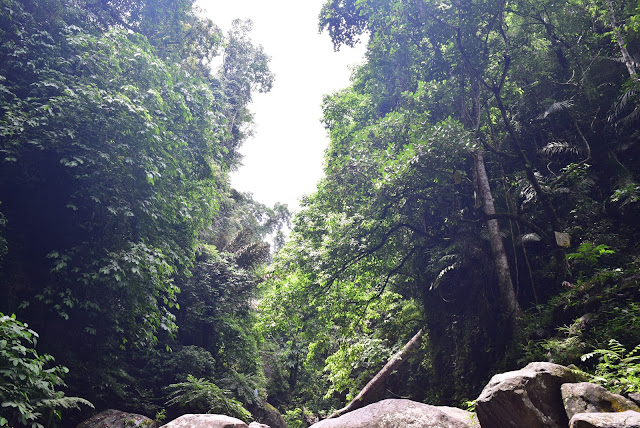
Third Segment
The descent from Tangbaw to Pethal is pretty straight forward. You'll have to walk for a few minutes through the community before you reach a wide trail leading down. Before taking the trail leading down, you can walk straight first to visit the Mt. Tangbaw Marker. It is just a 5 minute or so walk, then just backtrack.
This segment is probably the easiest in the entire climb. It will take you about 3 hours to reach the jeepney pick-up point and ascents are very minimal. The first hour will be composed of walking under the canopy of pine trees and wide trail as seen on the photo below.
 |
| The trail leading down the mountain |
 |
| The sari-sari store |
 |
| The Basura Man of Mt. Purgatory |
After three hours of walking, we finally reached the jeepney pickup point. We took lunch here while waiting for our ride to arrive. After an hour of waiting, the monster jeep finally arrived.
The jeep will then take us to the Bokod Municipal Hall where our van going back to Manila is waiting. Some of us rode at the top load just for the kicks, this is a bit of a bumpy ride so remember to hold-on to your seats. You'll pass by tobacco plantations and more of the mountain communities on your ride back to Municipal Hall.
 |
| The ride down to Bokod Municipal Hall |
This ride will only take about 15 to 20 minutes. Use of comfort rooms and shower rooms are available for only 20 pesos per head. Me and some of the boys used the shower rooms in one of the private schools near the Municipal Hall. After 48 hours, I can finally peel myself off of my sweaty clothes (hahaha!). It was damn refreshing.


 |
| Team IClimb |
It was tiring, punishing to the body and mind (my left knee hurts like hell during the entire descent) but it was worth it. What made it more worth it is the quality of people whom you climb with. Special thanks to iClimb Mountain and its organizer Sir Alfred Asan III.
After our "certificate shot", we finally boarded the van. As the wheels of the van slowly pick up speed, and the mountains slowly fades away in the distance, a sublime feeling came over me. I just survived another mountain. A pang of sadness, as I know I'll be leaving another small portion of my heart to this place.
Thank you Lord, Thank you for this gift of Life and Nature.
- Adrian Villaflor, 2018
Things to Consider

1. If there's one thing I'll never get tired of reminding people is to always practice Leave No Trail Principle. If you find yourself unwilling or incapable of following this sacred mantra, then mountaineering or any other nature activity is not for you.
2. Prepare yourself. Personally, I found Purgatory-Mangisi a bit easier than the other mountains I had climb. Probably because of experience and so many other things. But always put into mind that anything is difficult for an unprepared person.
3. Check the weather before climbing. It is imperative to always check the weather condition especially if you're going to a mountain in Cordillera. Heavy rains may result to landslides that may leave you stranded or worse.
4. Be mindful of your actions and words, especially towards the indigenous people (IP). Remember that all the locals you'll be interacting with will be an IP.
Check out this link to read the Top 25 Philippine Travel Blogs
Want to be updated on all your favorite blogs?
Feedspot is the best platform for you to read all your favorite sites in one place. Just create an account and enjoy countless of content from your fave bloggers.Check out this link to read the Top 25 Philippine Travel Blogs
No comments:
Post a Comment